
Sponsors: ♦ Wu Style Taichi (吳家太極拳) ♦
About us
HK intro
Easy Walk
River
Hiking
Coastine
Caving
Overseas
Gallery
Join us
Hiking tips
Other sites
Publicity
Contact us
Outdoor Doctor
FaceBook Group
Order FREE HK Travel Brochure!
Visitors
since April 2000
Pak Kung Au -- Sunset Peak – Wong Lung Hang Country Trail (伯公坳 – 大東山 – 黃龍坑郊遊徑)
Difficulty: NA
Last Visit: 21 Aug 2008
Lantau Island
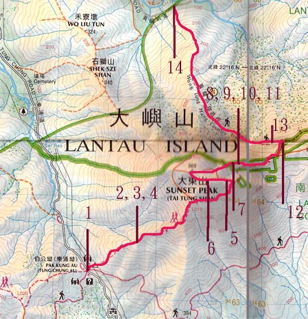
Trip DescriptionThis is a very obvious path. The first part is a session of Lantau Trail, and we walked up Sunset Peak on its way, and went back to Tung Chung with the Wong Lung Hang Country Trail. The most demanding part is the big-boulder steps in the latter part of the Country Trail. The steps go down from 480m to 160m. This can hurt your knees! |
Location 1: Altitude 340M
|
Location 2,3,4: Altitude 555M
|
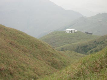
Location 5: Altitude 820M
|
Location 6: Altitude 840M
|
Location 7: Altitude 785M
|
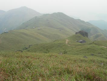
Location 8,9,10,11: Altitude 775M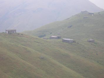
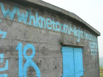
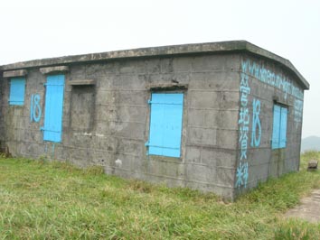
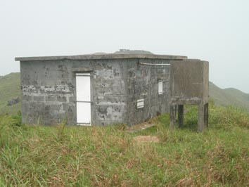
There are more than 10 small houses near that plateau. Each house is around 30 square meters. There is bedroom, dinning room, kitchen and toilet inside. There are pipelines providing water for living there. Old people called them Ghosthouse (鬼樓) or Lan Tau Ying (爛頭營). The most colorful House is No 18. On its wall, you can find the booking information. In the 50s, British workers overseas in a British company in Hong Kong had a feeling of nostalgia, so they applied for land from the Government to build their “bungalows” on Sunset Peak for holidays. Hikers can also fill up their water bottles near 820m where you can find a large water storage tank. |
Location 12: Altitude 715M
|
Location 13: Altitude 670M
|
Location 14: Altitude 160M
|


|
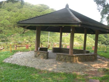 The starting point is Pak Kung Au where you can see a big shelter. The up-hill path is in fact difficult.
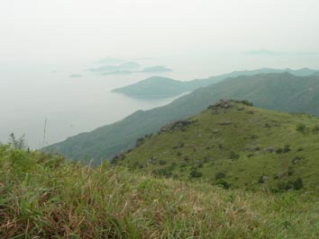 Going up for around 200m, you can start to see building scenery behind. You can see Lantau Peak behind you.
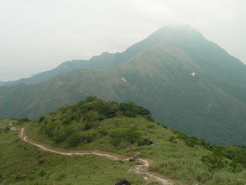
 You are at the bottom of the Sunset Peak. You can find some small but identifiable path to go up to the Sunset Peak
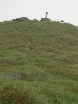 Almost reaching the top!
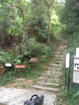
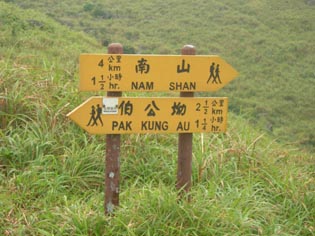 Walking downhill and joining the Lantau Trail again, you can see a a post stating the direction to Nam Shan.
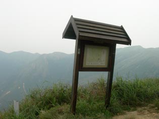 Turn left here to join the Wong Lung Hang Country Trail. There is a map.
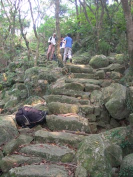 You go into one of the untouched forest of Hong Kong with tall trees on both sides. Along the trail, you can find big boulders going downhill. Along the Trail, you can see Yellow Dragon River. With the heavy rainfall in summer 2008, the entire path of Yellow Dragon has been widened and changed. When you look down from the Trail, you can see a big yellow strip (the Yellow Dragon River).
 This is the end of the journey. Walk along Wong Lung Hang Road to go to Tung Chung.