
Sponsors: ♦ Wu Style Taichi (吳家太極拳) ♦
About us
HK intro
Easy Walk
River
Hiking
Coastine
Caving
Overseas
Gallery
Join us
Hiking tips
Other sites
Publicity
Contact us
Outdoor Doctor
FaceBook Group
Order FREE HK Travel Brochure!
Visitors
since April 2000
PingJia River (屏嘉石澗)
Difficulty:

Last Visit: 29 May 2011
NT North
Trip Description
This river has the biggest pothole(壺穴) area in HK.
The lower stream is very famous for big pools, potholes and waterfalls, and more
importantly, the lower stream is easily accessible. Therefore, many hiking materials
rank this river as 2 stars.
| ||
Location 1: Altitude 0M
| ||
Location 2: Altitude 15M
|
 This is the entrance of the PingJia river. You have to pass through
some village neighbourhood before arriving here. There are quite a number of village guard dogs. Don't confront them.
This is the entrance of the PingJia river. You have to pass through
some village neighbourhood before arriving here. There are quite a number of village guard dogs. Don't confront them.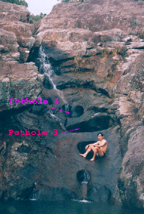 This is a waterfall at JiaLong Pool (嘉龍潭), it is about 35m high.
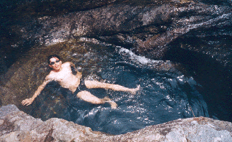
This riverfall has several big potholes. Lawman is sitting at the second one.
The bottoms of the third and the forth potholes are connected. Some hiking veterans said
that the a slim person could swim from forth pothole to the third one. When this
trip was taken, the tunnel between these two potholes has already been blocked
by rocks.
This is a waterfall at JiaLong Pool (嘉龍潭), it is about 35m high.
This riverfall has several big potholes. Lawman is sitting at the second one.
The bottoms of the third and the forth potholes are connected. Some hiking veterans said
that the a slim person could swim from forth pothole to the third one. When this
trip was taken, the tunnel between these two potholes has already been blocked
by rocks.
|
 This is the close up of the third pothole, it is a natural big tub.
 Lawman is pointing at the forth pothole.
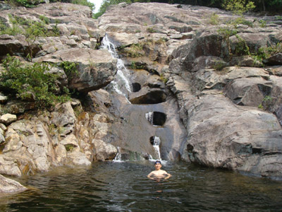
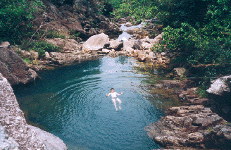 This full view of JiaLong Pool (嘉龍潭) was taken from the height
of the fifth pothole.
This full view of JiaLong Pool (嘉龍潭) was taken from the height
of the fifth pothole.
Location 3: Altitude 50M
|
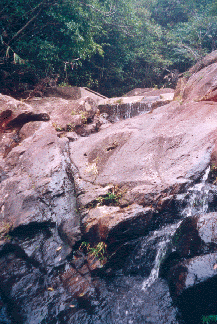
At 65M, you will find a very interesting rock with a big hole in it.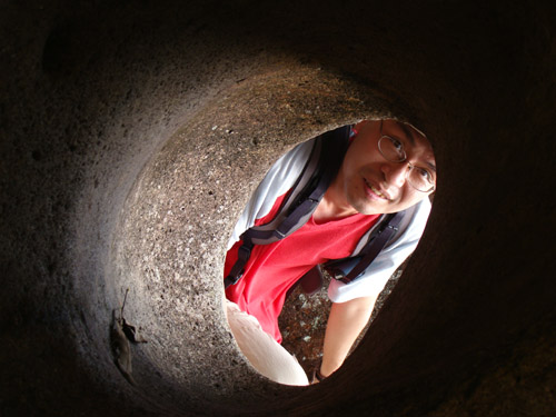  |
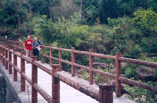
 Can you see concrete bridge in the upper part of this photo? This is first exit that you can leave
the river. Normally, after enjoying the JiaLong Pool (嘉龍潭), people leave the river
here. If you don't leave here, you will found a big dam shortly. There is a hidden
and steep passage on the left of the dam.
Can you see concrete bridge in the upper part of this photo? This is first exit that you can leave
the river. Normally, after enjoying the JiaLong Pool (嘉龍潭), people leave the river
here. If you don't leave here, you will found a big dam shortly. There is a hidden
and steep passage on the left of the dam.Location 4: Altitude 140M
 This is Qiao Shan Bridge(僑山橋). This bridge marks the second exit of the river and
the entrance of middle stream.
This is Qiao Shan Bridge(僑山橋). This bridge marks the second exit of the river and
the entrance of middle stream.
Location 5: Altitude 240M
 You are now in the middle of no where, you could only find a small
dam waiting for you. In the map, you might found an exit at about 250M. However,
that exit may be too faint to be easily discoverd.
You are now in the middle of no where, you could only find a small
dam waiting for you. In the map, you might found an exit at about 250M. However,
that exit may be too faint to be easily discoverd.
Location 6: Altitude 350M
 The upper stream of the river is much more hostile than the lower stream.
It is long and boring, it seems like you can never finish it.
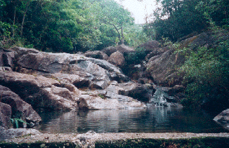
There are a couple of small pools and small waterfalls. Although small, those waterfalls
are not friendly at all. That is one of the reason why I rank this river as 4 stars.
The upper stream of the river is much more hostile than the lower stream.
It is long and boring, it seems like you can never finish it.
There are a couple of small pools and small waterfalls. Although small, those waterfalls
are not friendly at all. That is one of the reason why I rank this river as 4 stars.
Location 7: Altitude 435M
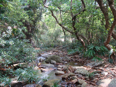
 As you go higher and higher, you will only find the river sneaking into
dense vegetation. Your only hope is to look for the red ribbons for guidance.
As you go higher and higher, you will only find the river sneaking into
dense vegetation. Your only hope is to look for the red ribbons for guidance.
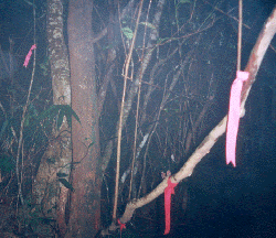
Hay! Here we go! At the exit of the river, you'll find a number of red ribbons (as shown in the picture)
showing the exit of the upper stream. After another 30min of trekking in forest, you'll find
yourself wind up in Wong Leng (黃嶺)!
You climbed along a river to Wong Leng from sea level!!!


