Trip Description
As its name suggest, this stream lies on the west side of Pai Ngak Shan (牌額山).
This is a short and fun stream. It packs with a number cliffs and waterfalls. In rainy seasons, the waterfalls could be magnificent. Those cliffs and waterfalls are visitor-friendly. They do not take you in-depth rock climbing skill and tenacious courage.
|
Location 1: Altitude 65M
 We are now gathering at the entrance of the stream. We have friends from UK, US and India joining the journey. The entrance is guarded by the dam. There is a narrow passage beside the fence on the right of the dam. The end of the narrow passage is a concrete footpath. We are now gathering at the entrance of the stream. We have friends from UK, US and India joining the journey. The entrance is guarded by the dam. There is a narrow passage beside the fence on the right of the dam. The end of the narrow passage is a concrete footpath.
|
Location 2: Altitude 70M
 After a few minutes walking on the concrete path, you will discover a rocky slope on your left that takes you to stream. After a few minutes walking on the concrete path, you will discover a rocky slope on your left that takes you to stream.
|
Location 3: Altitude 70M
 You will meet a small dam right after you have reached the stream. You will meet a small dam right after you have reached the stream.
|
Location 4: Altitude 95M
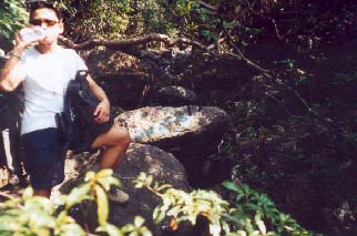 At this point, the stream splits. You should take a 90 degree right turn to continue the trip. Actually, there are many indication here to tell you to turn right. The highlight of the stream is waiting for you around this corner. At this point, the stream splits. You should take a 90 degree right turn to continue the trip. Actually, there are many indication here to tell you to turn right. The highlight of the stream is waiting for you around this corner.
|
Location 5: Altitude 105M
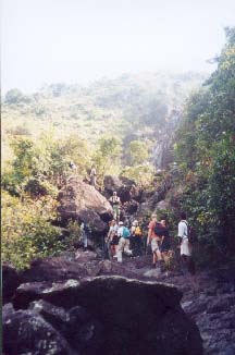 The stream begins to reveal a series of bony cliffs which will transform to majestic waterfalls in summer time. In dry seasons, the cliffs are pretty easy to be overcome. The stream begins to reveal a series of bony cliffs which will transform to majestic waterfalls in summer time. In dry seasons, the cliffs are pretty easy to be overcome.
|
Location 6: Altitude 130M
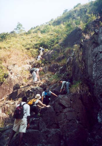 You could scale up the cliff on its left. You could scale up the cliff on its left.
|
Location 7: Altitude 165M
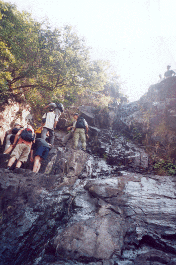 Cliffs come one by one. Above this cliff is a wide "flat" open area with intriguing view. It is an excellent place for lunch and enjoying the placid wilderness. Cliffs come one by one. Above this cliff is a wide "flat" open area with intriguing view. It is an excellent place for lunch and enjoying the placid wilderness.
|
Location 8: Altitude 200M
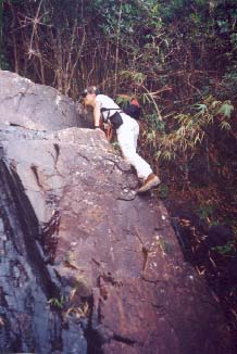 After your lunch, you will find the stream begins to get narrow. Don't worry, the stream is wide enough for comfortable trekking. After a while you will find a 4 meter rock wall blocking your way. You could take a path on the left to by-pass the rock wall. Or if you're confident enough, you could proof your agility by climbing the wall. As a matter of fact, it is not as difficult as it seems. Yet, great care should be taken for doing so. After your lunch, you will find the stream begins to get narrow. Don't worry, the stream is wide enough for comfortable trekking. After a while you will find a 4 meter rock wall blocking your way. You could take a path on the left to by-pass the rock wall. Or if you're confident enough, you could proof your agility by climbing the wall. As a matter of fact, it is not as difficult as it seems. Yet, great care should be taken for doing so.
|
Location 9: Altitude 230M
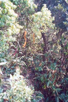 The last part of the stream is accompanied by pristine forest. Again, don't panic, the trek is still easily recognizable. At this height, you will leave the stream and return to a open area with grassland and proper hiking trail. The last part of the stream is accompanied by pristine forest. Again, don't panic, the trek is still easily recognizable. At this height, you will leave the stream and return to a open area with grassland and proper hiking trail.
|


|

