
Sponsors: ♦ Wu Style Taichi (吳家太極拳) ♦
About us
HK intro
Easy Walk
River
Hiking
Coastine
Caving
Overseas
Gallery
Join us
Hiking tips
Other sites
Publicity
Contact us
Outdoor Doctor
FaceBook Group
Order FREE HK Travel Brochure!
Visitors
since April 2000
Kauliu (較寮) to Nei Lak Shan Country Trail(彌勒山徑)
Difficulty:

Last Visit: 10 Oct 2010
Lantau Island
Trip DescriptionThis ridge lies next to the Ngong Ping 360 cable car. The Ngong Ping 360 Maintenance Trail (昂坪360維修道) is well constructed while this trail is very primitive. Although it is major mountain ridge, it is not as popular as it should be. Therefore the trail remains narrow and faint. It is not difficult to navigate though, there are plenty of ribbons along the way. Because of the brushy nature, you are highly recommended to put long trousers. | ||
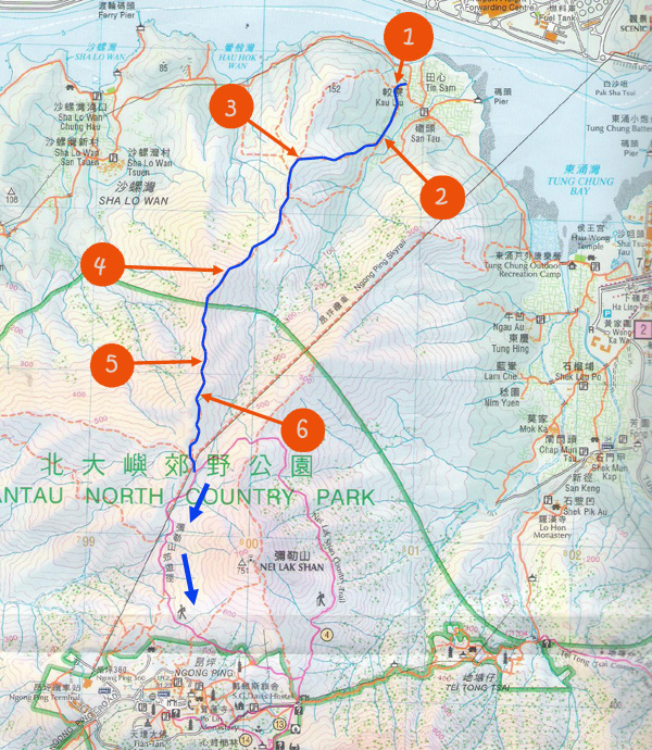
Location 1: Altitude 20M
It takes some times for us identify the entrance. There is a water piple on the left of the path that lead us to the entrance of a stream (left picture). We then followed the concrete path and eventually we rearched a junction with yellow ribbons. Just follow the direction indicated by the ribbon (right picture). We have made attempt to the small peak of 152M but the path was totally submerged in dense vegetation. So, we gave up the 152M-peak and walked parallel to the stream instead. | ||
Location 2: Altitude 45M
| ||
Location 3: Altitude 195M
| ||
Location 4: Altitude 410M
| ||
Location 5: Altitude 500M
| ||
Location 6: Altitude 555MEuropeans enjoying Hong Kong ridges. | ||


|

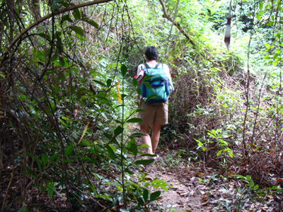
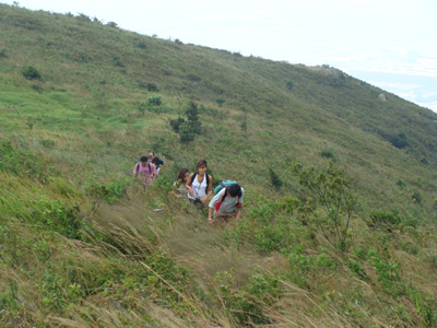
 After dashing through a narrow brushy pathway, we arrived at the stream. You have to trek up the off-shoot on the right a little bit in order to continue journey. You can just follow the ribbons. We were following a faint footpath scaling up to the ridge.
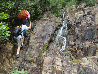
  We finally emerged from the brushy forest.
 Trekking on the windy ridge.
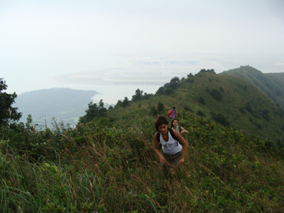 The background is HK international airport.