
Sponsors: ♦ Wu Style Taichi (吳家太極拳) ♦
About us
HK intro
Easy Walk
River
Hiking
Coastine
Caving
Overseas
Gallery
Join us
Hiking tips
Other sites
Publicity
Contact us
Outdoor Doctor
FaceBook Group
Order FREE HK Travel Brochure!
Visitors
since April 2000
Dragon's Jaw (龍顎石澗)
Difficulty:

Last Visit: Nov 2006
Lantau
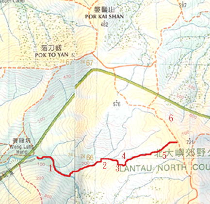
Trip DescriptionDragon's Jaw is in fact the most outstanding feature of a large right stream of the Couching Dragon River. The Jaws mean a narrow entrance of a gorge, and it is a large vertical or hanging cliff in the middle portion of the right stream of the Couching Dragon. It is a highly energy-demanding stream and it can be very dangerous during rainy season. | ||
Location 1: Altitude 75M
| ||
Location 2: Altitude 230M
| ||
Location 3: Altitude 320M
|
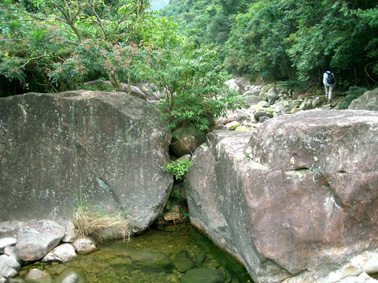 It is still the main Yellow Dragon with huge stone. Please notice that you have to observe the entrance to the Couching Dragon River at 100m
 This is the critical point of the journey. You can find in fact three paths. The left one is the continual route of Couching Dragon. The left one leads you to Dragon's Jaw.
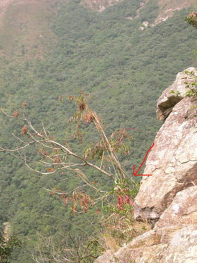
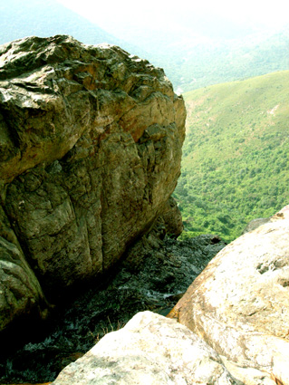
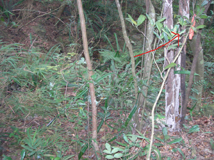
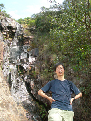 The picture shows the Dragon's Jaw. Notice that behind Anthony is the waterfall. The top of waterfall looks like water flowing out of the mouth of the dragon (Jaw). The second picture shows a red cloth hanging on a large branch on the left side of the cliff (if you are facing the cliff). It is a key feature to inform the hikers about the waterfall. The third picture is the view down the valley. There is a path on the right side of the Jaw.
 |
 |
Location 4: Altitude 360M
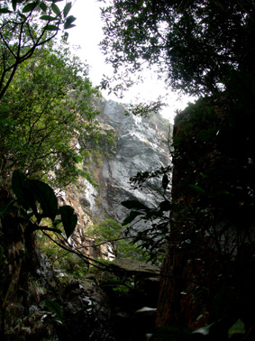 You will soon reach the forestry area if you walk through the hidden path on the left right side, and perhaps it is the most dangerous part of the journey. You will soon reach a second big pool (after the Jaw) where you can see the large cliff again (2nd picture). Then you can see that ribbons are tied on both the left and right sides of the cliff. To stay along the river and continue the journey, go to the left side. You will find less water flowing the stream after this point.
Location 5: Altitude 500M
 You can see ribbons along the narrow stream. You are basically in a forest.
Location 6: Altitude 600M
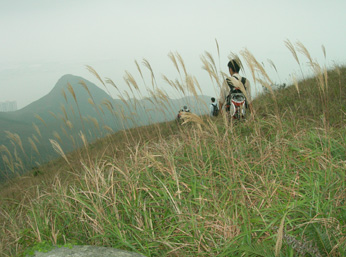 After you leave the stream at around 640m, you have to go through long grasses to cut to the main footpath. It is really a demanding part. And at 600m, you can see Por Kai Shan is in front of you. There is an overt path for you to walk to Tung Chung. It takes around one and a half hour at least.


