Trip Description
| This trip starts from Pak Long (北朗) near Lung Kwu Tan (龍鼓灘). The goal is to find the Bread Rock (方包石). We will pass by a slight-seeing feature called Emperor Rock (皇帝巖). It was said one of the Chinese king fled and stop by the huge rock for temporary shelter hundreds years ago. There is a well paved path taking you there from Pak Long bus station. |
 |
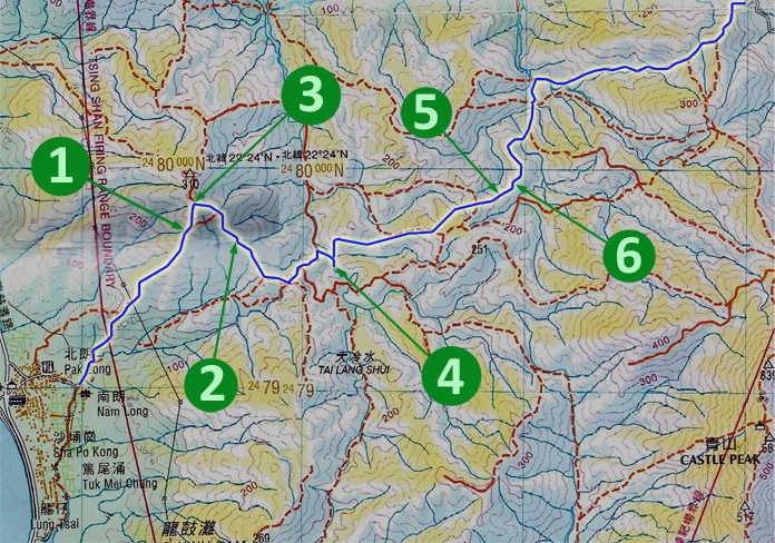
| Shortly after the Emperor Rock, the footpath ends. You have to start real hiking by climbing over the yellow fence. |
 |
|
Location 1: Altitude 260M
 The hiking paths in this area are very sandy and slippery. Hike carefully.
|
Location 2: Altitude 310M
 We turned right. Although we don't exactly follow the path on government countryside map, trust us, follow ours.
|
Location 3: Altitude 270M
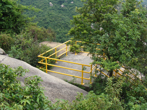
| This is Rock Pile Top (疊石頂) which is good place for reading and meditation :) |
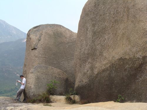 |
| This the Rock Pile Top shot from below. |
 |
|
Location 4: Altitude 175M
 Finally we found the Bread Rock. It is located on a small stream. It really looks like pieces of bread. This photo is called Club Sandwich.
|
Location 5: Altitude 210M
 They were overcoming another sandy uphill climb.
|
Location 6: Altitude 225M
 From here, you can follow the government countryside map to head to the nearest concrete rock (良景凹) which will take you to Tun Mun (屯門) down town.
|


|