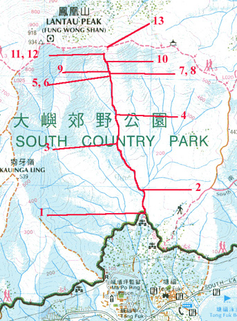
Route Description
As many old Hong Kong hiking guides said, South Heaven Gate is the most well-known "classic perilous hiking route of the territory." Stretching for the entire south-eastern side of the Sunset Peak down to Tong Fuk, it resembles a corridor leading to the southern sky and cutting through the cliffs and rocks of the Peak. South Heaven Gate is often associated with the equally-challenging North Heaven Gate located at the back of the South Gate (north-western back of the Peak); and they two are commonly called "South-North Heaven Gate." Perhaps, you might attempt to go up to one of the "Nine Dragons, One Phoneix" of the Lantau, some of which might be less demanding. However, both streams of the South-North Gate are very difficult and you might try to avoid it without proper guidance.
South Heaven Gate can be divided into three parts. The first part is the lower part of the river which cuts across a alluvial flatland called Yellow Muddy Pit/Trench. This part cover many branches of the river, and can easily lead you to a wrong route. The second part is the native forest areas. The entire route is covered by tall old trees, many of which are indigenous, non-commonly seen species (e.g. Sloanea hongongensis Hemsl. and many kinds of Fagaceae) in Hong Kong. The last part is the Heaven Gate Valley area where most dangerous cliffs are.
1
105M
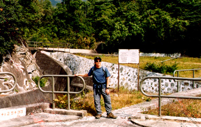
The starting route of the South Heaven Gate is called Heaven Gate Stream. The entrance is along the session 3 of the Lautau Trail. The easiest way is to walk along the concrete path by-passing Ma Po Ping Prison and join the Lantau Trail. Going east along the Trail, you can find a catchwater (South Lantau Catchwater) beside the trail. The entrance is near a water collection area where you can see a bridge, a small dam and some fences (HE019617). Be careful, there is the Fung Tong River just a few hundred meters from the Heaven Gate Stream. Do not enter the Fung Tong River otherwise you will head to QingTian Gorge. Since the Heaven Gate Stream (天門石澗)is a bit deep near the entrance, enter the river along the right side where there are some concrete features and dry lands.
2
135M
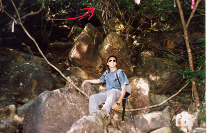
You start to walk along the alluvial where you will encounter different branches of the river. At this point, identify a left path. Perhaps it is the most confusing route along the whole stream, many people tie many red ribbons, and you can along see a thick branch of a tree cutting across the route.
In general, follow the red ribbon. There are ribbons of other colors leading to different branches.
3
250M

Probably you start to find small pools along the journey. The pools are most covered under trees. The path starts to get wider but less obvious. In general, you will find that the river is turning left. As you walk along, you start to climb up the hill slowly and enter the forestry area of the river. The road starts to get a little slippery as you are walking under tall, old trees. You can also explore the species of the forest area. Very interesting.
4
325M
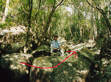
Stay alert at this point. You have to make a critical decision here. You can see a guy Kei sitting on a stone. On the left side of him, it goes to a place called Tea Pot Mouth Trench or Phoneix Pot River, again, a four-star journey. On the right side of him, it is the correct path leading to South Heaven Gate. Follow the direction of arrow.
5
515M
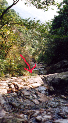
Around 480M, you suddenly goes out of the forest, and start to see the mountain ahead (although the South Heaven Gate is still unseen). This is the Heaven Gate area. Then prepare yourself. There are three challenges of Heaven Gate Valley, each of which is characterized by a long rope (mostly red rope). This picture is taken just above the first challenge (below the arrow) where you have to climb up, quite unexpectedly, a cliff. Although the cliff is not extremely high (around 2-3 meters), it is very steep. You have to somewhat rely on the rope. The path has a terrifying name, Yin Yang Route, meaning the road to death. Actually, you can see that usually one side has a bright sunshine and the other quite a shadow.
6
515M
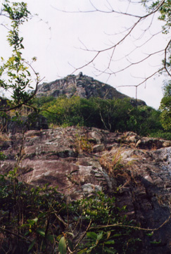
If you long up the path ahead, you can see exactly the same picture. You can't find the Heaven Gate. You can see very steep cliffs, one above one another. In general, try the right side of the cliff.
7
535M
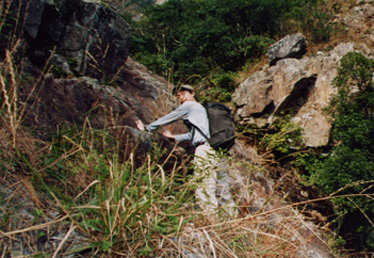
This is the most tiring part of the journey. Don't think that the person in the photo (Kei) is taking a rest. No! In fact, he has just seen the second challenge, which is the most difficult part of the journey. He has to think how to tackle it. He now has to climb a very long steep rocky faces where initially he doesn't have rope to hold on. If you fall, you will go down to the very bottom of the series of cliffs. But in fact, when you take the first challenge, you can't go back.
The clue to overcome the challenge is to climb up a bit the big stone in front of Kei and move to the left side. Don't fall. And then you can have some hand holes to climb up (foot holes less overt though) for a meter. Then you start to see ropes of the second challenge. With its help, you can slowly climb up. Beware. Don't count on the ropes completely. The ropes are quite loose.
The third challenge is also ahead. If it is not rainy, you are lucky. But there are still water running down. You can stick to the right side of the path (which is a big ditch) where you also find a rope. Climb along it which is around 70 degree steep.
8
535M
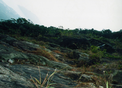
Looking ahead. Believe it or not. Climbing over the second challenges, you can find some flat steep rocks where you temporarily take a rest.
9
535M
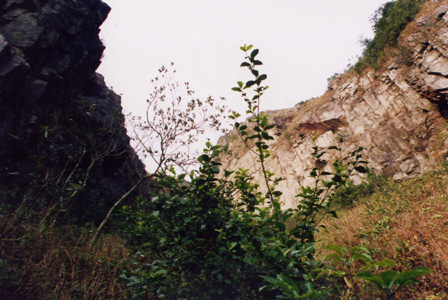
Walk up the path a few step, you start to see the Yin Yang Wall (陰陽壁) ahead (dark left side and bright right side). On the right side, there is also a wide grassland full of plants with hooks and spine Somebody called it "Ghost Spiny Forest" But in fact, it is a bit exaggerating. Comparing the difficulties of the cliff, the difficulty of this part is very minimal.
10
605M
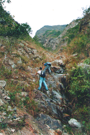
This is the last dangerous part. Like the guys, you need to climb in the middle-left of the cliff which is around 80 degree. You can also see the pyramid like top ahead. After the last creepy climb, you will find that the South Heave Gate is ahead. There you can see a long black cliff and there is no way you can climb up the vertical cliff. Enter the left valley and you will climb up some rocky roads where you can actually skip the Gate and walk up to the Lantau Trail. But I guess you won't miss the South Heaven Gate.
11
700M
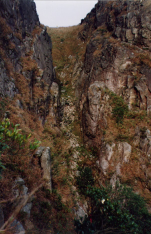
Then you can see a little path walking to the bottom of a valley. You are exactly at the bottom of Heaven Gate Valley where numerous small stones have accumulated.
12
700M
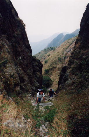
The stones are very loose. When you walk, the rocks will fall. My advice is not to stay on the stones for a long time. Go fast. The two guys in the picture just passed the Heave Gate Valley.
13
715M
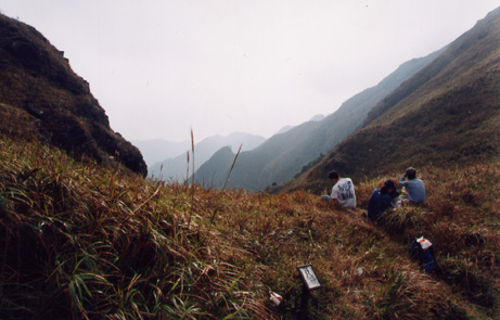
Walking out of the South Heaven Gate, you will see the mark of Lantau trail. Sitting here on the grass, you won't realize that this is actually the South Heaven Gate.


