Sharp Peak (南蛇尖) is one of the famous mountains in Hong Kong. It is literally visible from every part of Sai Kung. It is known for its sharpness, steepness and , of course, the greatness of view. There are a number of routes that lead to the top of Sharp Peak, the steepest of all is the north ridge. This route is not even shown in the offical Countryside map published by Hong Kong Government.
The left slope on the adjacent picture is the north ridge. Its gradient increases dramatically at about 300M. Some people may opt to take on the sheer cliff. It is really a perilous act. Well, there is always an alternative, at about 375M, the footpath sneaks into a forest on the left to avoid the daunting cliffs. However, the forest is equally steep, it is definitely not for the unprepared.
1
35M
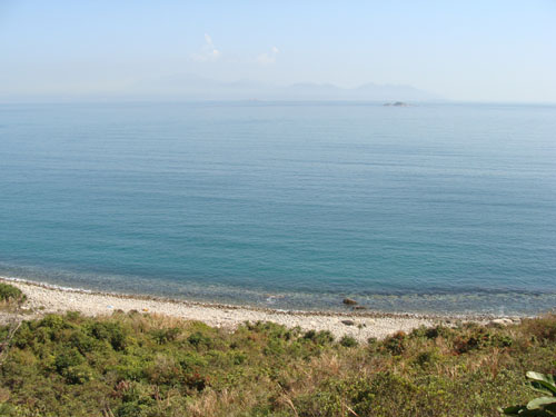
We started from the pier in Ko Lau Wan which could be reached from Wong Shek pier by ferry. Eventually, we followed some water piple to Nam She Wan (南蛇灣).
2
35M
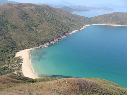
We were accompanied by a beautiful beach on our way to Nam She Wan (南蛇灣). What a beauitful day, we got blue sea, blue sky and subtropical sunshine.
3
55M
Here we have to leave the water pipe path and move down to the Nam She Wan (南蛇灣) via a bushy way.
4
0M
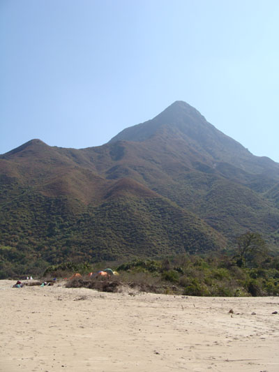
There were some campers in Nam She Wan which is a very quite beach with fine sand. We could also see our sharp destination, the Sharp Peak.
5
0M
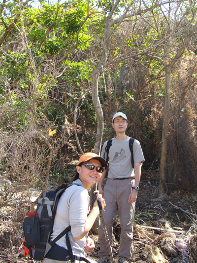
Ok, let's go. There is an opening in the bush marked by colourful ribbons. It is located in the begining of the rocky shore. It is our real starting point.
6
45M
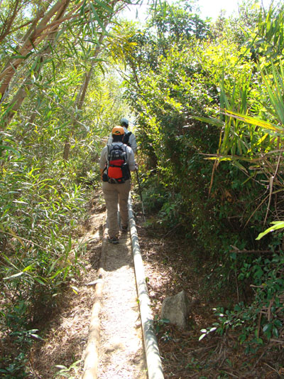
It starts off with a steep and bushy path.
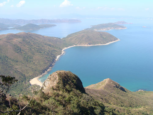
7
60M
We looked back to see a breath-taking scenary. It just looks like some holiday resort in an upscale vacation area.
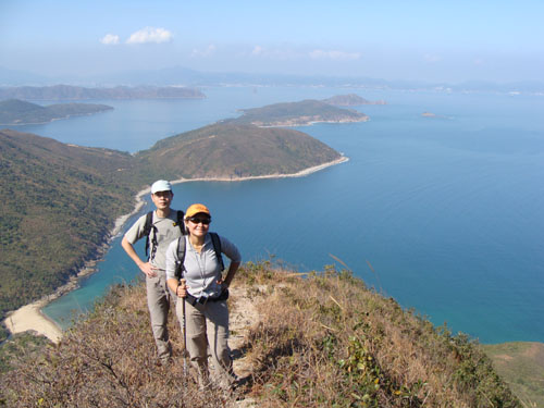
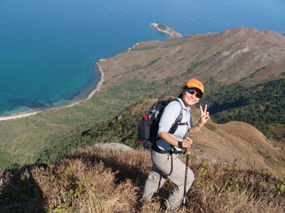
8
190M
We climbed up more and saw more.
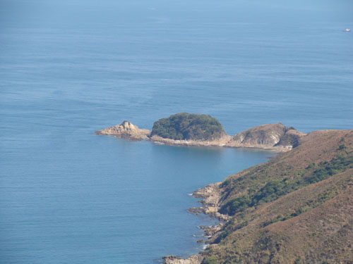
This is Mei Fan Tsui (米粉咀).
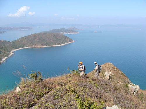
9
225M
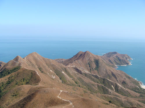
We could now see Grass Island (塔門) and East Dong Pin (東平洲).
10
335M
The daunting cliff of Sharp Peak North Ridge.
My teammates were happy to get a close glimpse of long-waited ridge.
11
365M
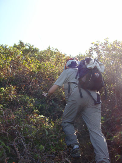
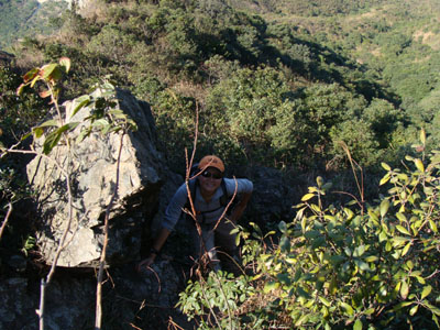
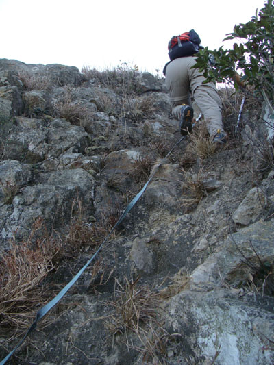
The maneuver is getting demanding.
Let's have one more look of the beautiful sea before we dive into the forest. Here we were almost facing the cliff eyeball-to-eyeball. So we picked the path that leads to the forest on the left. It is however, the forest actually locates above a even more vertical and much deeper cliff. Slipping is not an option.
12
M
We are inside the steep forest.
13
435M
More video inside the forest.
14
460M
We were only a few meters from the top. The last few meters are sandy and damn steep. The metal strip is definitely of some help.
15
468M
We finally reached the top intact. :-)
Nam She Wan (南蛇灣) again.
Mai Fan Teng (米粉頂) bathed in warm winter sun.
We then followed the south ridge and got back to Malehose Trail section 2.