Pok To Yan (泊刀屻)
Difficulty:

16 Dec 2001
Lantau

Trip Description

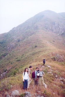
Pok To Yan is a medium long ridge runs from Tung Chung towards the centre of Lautau Island. Pok To Yan's ridge is not as sharp as that of Dog Teeth Range. The slope on the west end of Pok To Yan is quite steep and strenuous. The picture on the right captures the whole view of Pok To Yan.
There has been some constructions near the west entrance of Pok To Yan over past decade. Now the west entrance is not obvious to hikers. Should you want more information on the entrance, please contact webmaster.
Location 1
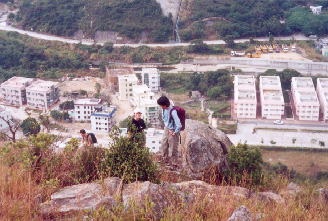
 Altitude : 140M
Description :
We are now struggling on the steep slope on the west of Pok To Yan. The background of the photos is Ma Wan New Village.
Location 2
Altitude : 230M
Description :
We are now about to overcome the steepest face of Pok To Yan.
Location 3
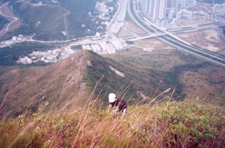
Altitude : 395M
Description :
The lady in the picture has nearly finished the steepest portion of Pok To Yan. After this point, the path begins to flatten off. Hikers will eventually meet other major trails.
![]()
![]()
![]()
![]()