Ma On Shan Tsuen-Ngong Ping ®¨Ñ¡ - Pak Kong Ñ_┤õ
NT North
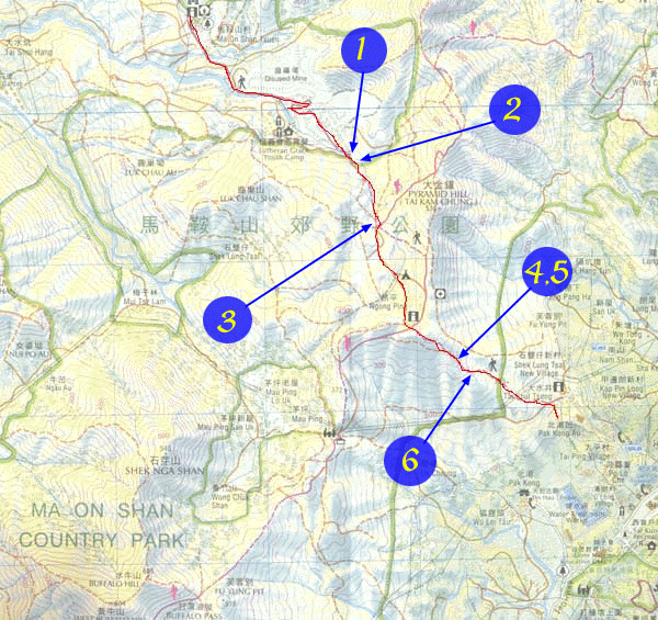
Location 1

 Altitude : 315M
Description :
You can take a taxi to reach the Ma On Shan Tsuen or the Information center of the Fishery and Agricultures Dept (near Hang On Estate ½Ýªw). Take any paths to walk up the hill, and you will find some old sign showing the direction up to Ma On Shan Country Park . Rocky road replaces the concrete path at around 315m
Location 2

Altitude : 320M
Description :
You will find a very large ground suddenly at 320m
Location 3
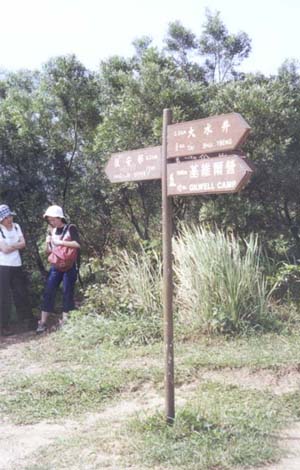
Altitude : 415M
Description :
You will find a sign post pointing toward two directions: Kei Ling Ha Ñ°└¡ñU and Tai Shui Tseng ñjñ¶ñ½ (2.2km) / Gilwell camp ░‗║¹║©└þ(7km). Noticed that you are frim Hang On estate. Go along the direction of Tai Shui Tseng (where you are along the MacLehose trail)
Location 4
Altitude : 410M
Description :
Campsite near Ngong Ping on the right side and on the left side is the Pyramid Hill ñj¬¸─┴
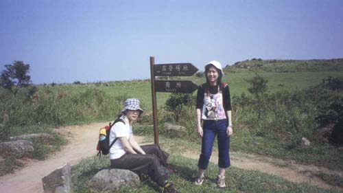
Location 5
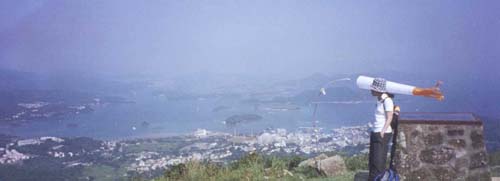
Altitude : 410M
Description :
There is a view compass on the left side where you can see a nice view of Sai Kung. You can always find someone playing parachute near this point. It is windy there. You will soon reach a crossroad where you can find an information board and a shelter. You have to choose to go along the MacLehose Trail to the Gilwell Camp, or to Tai Shui Tseng and Pak Kong Au
Location 6

Altitude : 290M
Description :
While going down the hill, another post sign showing the direction to Pak Kong and Mau Ping ¡T®W . Go down to the Pak Kong path, and when you reach the concrete path, turn left to go out to the main road.
![]()
![]()
![]()
![]()