Moon Gully(¤ë¤ú¨¦)
Difficulty:

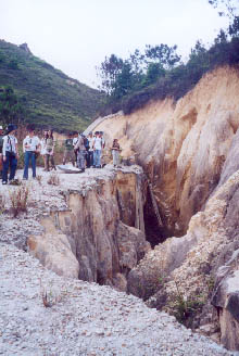
21 April 2002
NT West
Trip Description
The Castle Peak area is an area of bald. It does not bear dense forest as many other mountain ranges do. During the Japanese occupation of Hong Kong in WWII, Japanese troop came here and harvested the wood for construction. The land was then deforestized. Half a century later, this naked area has been severely eroded. Forest has gone, gullies and sandy soil have left.
One of the gullies is called Moon Gully (¤ë¤ú¨¦) whose shape resemble a crescent moon. It locates near the upper stream area of Qing Dai Stream (˛M¤jĄŰĽî) (click here for more Qing Dai Stream information).
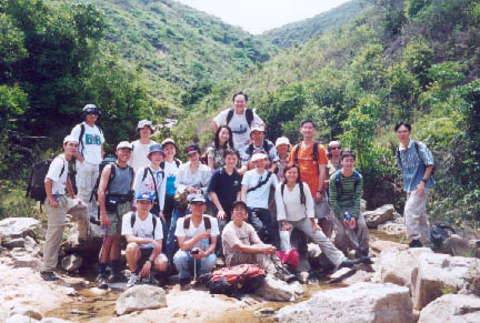
We set off from Leung King Estate (¨}´ş§ř), and followed a concrete path to the middle stream of Tsing Tai stream. Lastly we left the upper stream and took a close look at The Moon Gully. The hiking trails in that area are very confusing. Take care.
Location 1
 Altitude : 75M
Description :
As we talked towards the middle stream of Qing Dai stream, some deep wide cracks showed up.
Location 2
Altitude : 30M
Description :
Here we met the Qing Dai Stream and began to hike along the stream. Since there is no resident in the upper stream, Qing Dai Stream is a pretty clean water system.
The valley behind us accommodate the Qing Dai Stream.
Location 3

Altitude : 100M
Description :
We are now the top of Four Stacking Pools of Qing Dai Stream.
Location 4
Altitude : 160M
Description :
Now we leave the stream and start our search for Moon Gully.
Location 5
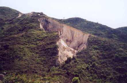
Altitude : 185M
Description :
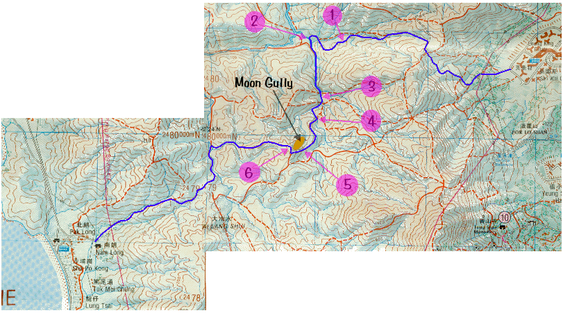
Here it is! The Moon Gully.
Location 6
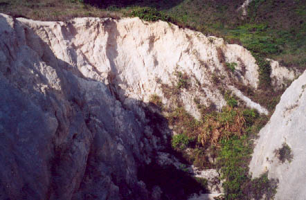
Altitude : 240M
Description :
This picture was taken at the upper end of the Moon Gully.
![]()
![]()
![]()
![]()